Every excavation carries risk. Utility Detection and Ground Penetrating Radar (GPR) surveys provide a clear understanding of the buried infrastructure beneath your site before work begins.
Using a combination of electromagnetic locating equipment and advanced GPR technology, we identify and map underground services including electricity cables, gas pipelines, water mains, drainage networks and telecommunications infrastructure.
By accurately locating buried assets prior to excavation, design or construction activities, we help clients reduce risk, avoid costly service strikes and make informed project decisions with confidence.
Whether supporting residential developments, highways projects, commercial construction or infrastructure schemes, Precision Site Engineering delivers reliable utility mapping tailored to your project requirements.
HOW UTILITY DETECTION HELPS REDUCE PROJECT RISK
WHY IS IT IMPORTANT?
Unknown underground services are one of the most common causes of construction delays, programme disruption and unexpected costs.
Accurate utility information enables safer excavation, reduces the likelihood of utility strikes and helps project teams understand site constraints before design or construction activities begin.
By identifying buried assets early, clients can improve site safety, reduce project risk and avoid unnecessary delays.
What You'll Receive
Every project is tailored to client requirements, but deliverables typically include:
AutoCAD DWG files
PDF Utility plans
PAS 128-Compliant Deliverables
Utility Mapping Reports
Why Choose Precision Site Engineering?
Utility information is critical to the safe planning and delivery of construction projects.
Our experienced survey team combines advanced detection technology with industry best practice to provide accurate utility mapping that clients can rely upon. Using a combination of electromagnetic locating equipment and Ground Penetrating Radar, we help reduce uncertainty and improve site safety before excavation begins.
From housing developments and commercial construction projects to highways and infrastructure schemes, we deliver dependable utility survey information that supports informed decision-making.
Typical Applications
Planning
Utility information to support site feasibility studies, planning submissions and design development.
Residential
Identification of buried services before earthworks and construction works commence.
Infrastructure
Utility mapping for highways, drainage, rail, utilities and civil engineering schemes.
Commercial & Industrial Sites
Locate existing services to reduce risk during redevelopment, extension and construction projects.
Scan to BIM & Digital Modelling // Utility Detection & GPR
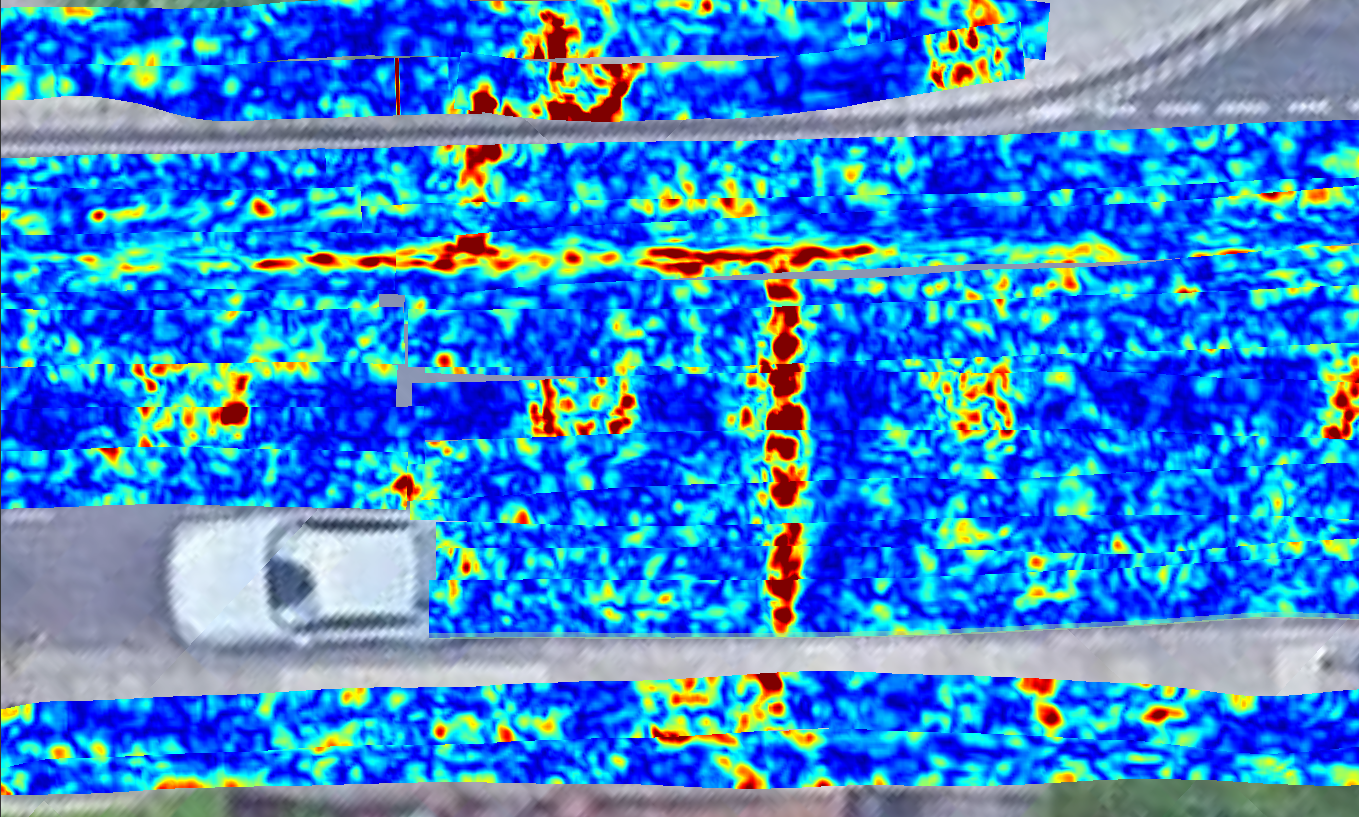
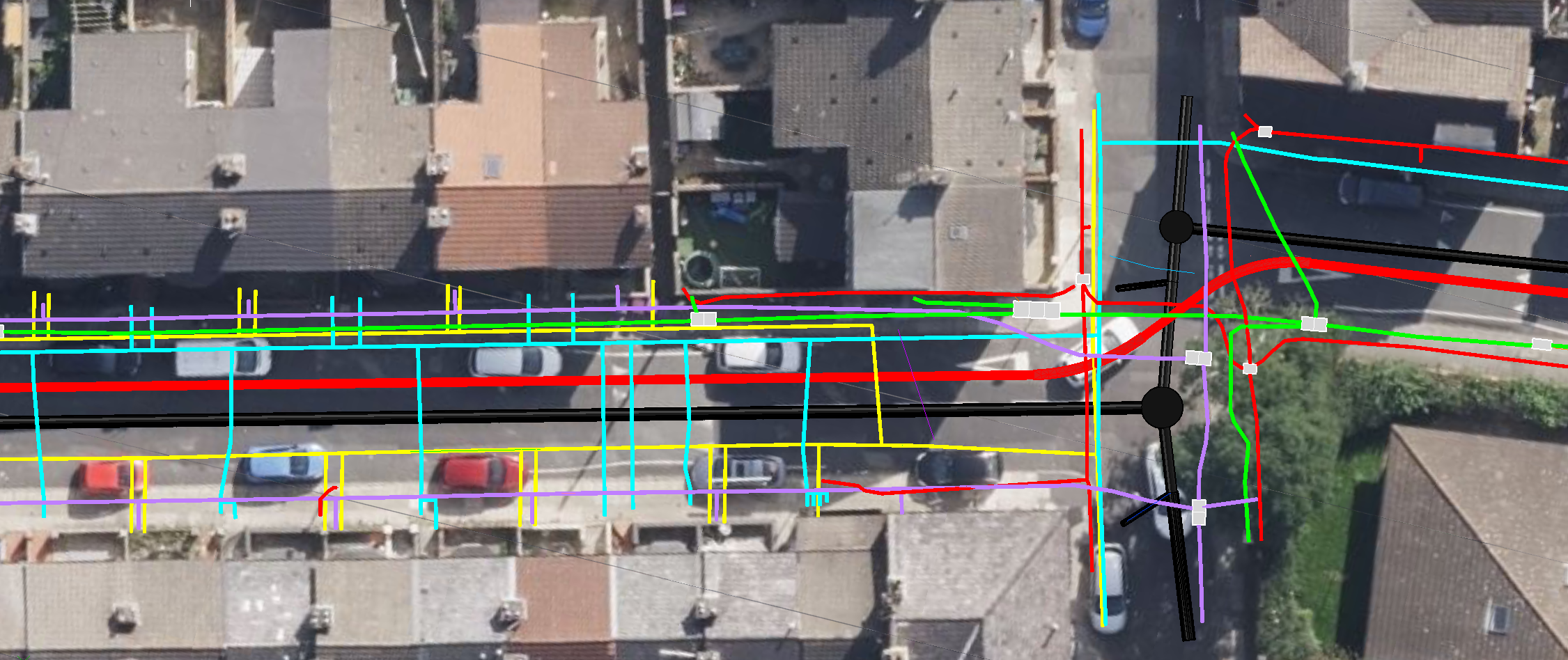
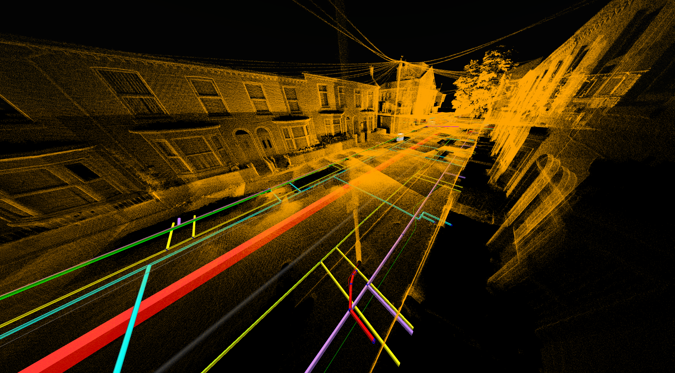
PAS128-compliant utility detection, GPR surveying and 3D utility modelling undertaken along Lancaster Street, Bootle to support future infrastructure works.